A Brief History of Maplewood
Earliest Inhabitants
The earliest known residents of Maplewood were from the Native American Woodland Culture and are estimated to have lived here between 500 B.C. and A.D. 1500. Stone arrowheads and pottery shards have been found along Fish Creek from Carver Lake to the Mississippi River as well as on the east side of Keller Lake and Kohlman Lake.

Pottery shards from Fish Creek
Between 1727 and 1763, the Dakota arrived from Mille Lacs Lake and started their village, Kaposia, on the east bank of the Mississippi. This was a seasonal village. Between 1763 – 1838, its location was reported to be as far south as the Mississippi/St. Croix River junction to as far north as today’s downtown St. Paul. Maplewood was probably their hunting area and small groups were reported by early settlers to be camped around Casey Lake and Carver Lake.

The Dakota village of Kaposia. Courtesy Minnesota Historical Society
The Arrival of the First Europeans
Our written history begins when European and French-Canadian settlers began farming in this area. In 1850, a group of families ventured north from St. Paul along an Indian trail that is now Hazelwood Street. They were the Bells, Caseys, and Vincents. At today’s County Road C, they turned to the east and began to build their log cabins. The sound of their axes alerted the Dakota who had a hunting camp nearby and thought the land was still theirs. The Dakota asked them to leave and the newcomers quickly retraced their steps. The settlers made repeated attempts to claim the land they had bought for two dollars per acre from the Federal government. In 1853, after the Dakota moved to a reservation on the Minnesota River, the pioneers could build their cabins. About this same time, southern Maplewood was first settled when Thomas Carver began farming in 1852 on the west side of Carver Lake.
Early Transportation
The first organized transportation in this area was a stagecoach line that ran north along Edgerton Street and DeSoto Street from St. Paul to Duluth. This line was started in 1856 and the cost for a 36-hour 156-mile trip was 10 dollars ($302 in 2020). The line remained in service until the first railroad was completed from St. Paul to Duluth in 1870. This was the Lake Superior and Mississippi Railroad that followed today’s Bruce Vento Trail. In 1877 it was reorganized as the St. Paul and Duluth Railroad and in 1900 it was acquired by the Northern Pacific Railroad. Still, later it became the Burlington Northern Santa Fe Railroad.

The last stagecoach from St. Paul to Duluth in 1870.
In 1884-86, the Wisconsin Central Railroad built a line from St. Paul to Wisconsin that intersected with the St. Paul and Duluth Railroad at Lake Phalen Junction.
Gladstone
Lake Phalen Junction was renamed Gladstone in 1887 when William and Mary Dawson purchased the adjacent land, platted a townsite, and predicted it to “rival St. Paul”. The townsite was named after William Gladstone, a popular British statesman of that time. Dawson relocated his St. Paul Plow Works to the northeast corner of the railroad intersection and convinced the St. Paul and Duluth Railroad to build their maintenance shops in the southwest corner, which is today’s, Gladstone Savanna. For a time, Gladstone prospered and by the 1890s, the businesses employed 1,000 workers. It had a post office, a hotel, at least two saloons, a brothel, and a population of about 150.

The St. Paul Plow Works factory in Gladstone in 1895
But Gladstone suffered a series of misfortunes that led to its demise. First, a fire destroyed the Plow Works in 1892. The company rebuilt but in 1896, the major stockholder, William Dawson, filed for bankruptcy. In 1903, the plant reopened under the name Poirier Manufacturing Company but it declared bankruptcy in 1908.
In 1910, the railroads changed the name of the depot to Gloster to avoid confusion with Gladstone, Michigan but locals continued to call the area Gladstone. The last straw for Gladstone’s industries was when the railroad shops closed around 1917. Gladstone became a semi-ghost town by the 1920s with many people leaving for jobs elsewhere. The price of houses dropped and the burning of houses to collect insurance money became a regular occurrence. Trains still operated and some residents commuted to work in downtown St. Paul. The depot continued in operation through the 1950s.

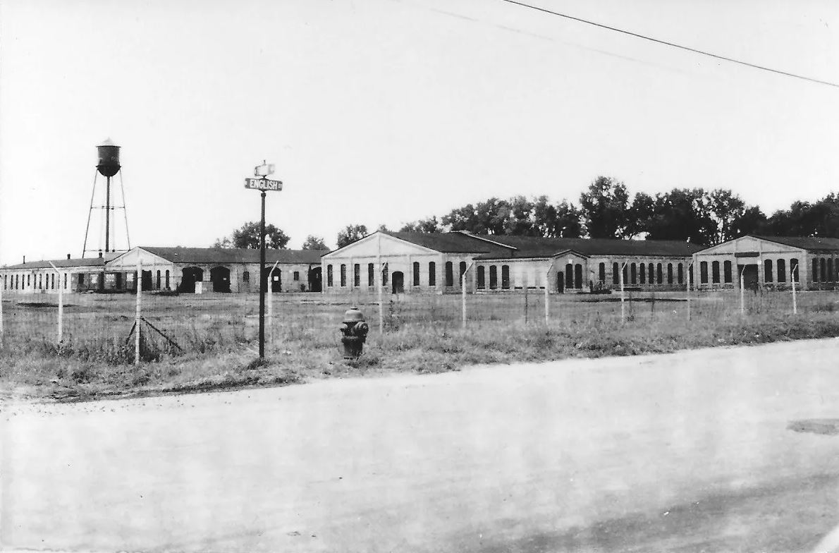
The St. Paul & Duluth Railroad shops in Gladstone became a warehouse for Whirlpool in 1949.
McLean and New Canada Townships
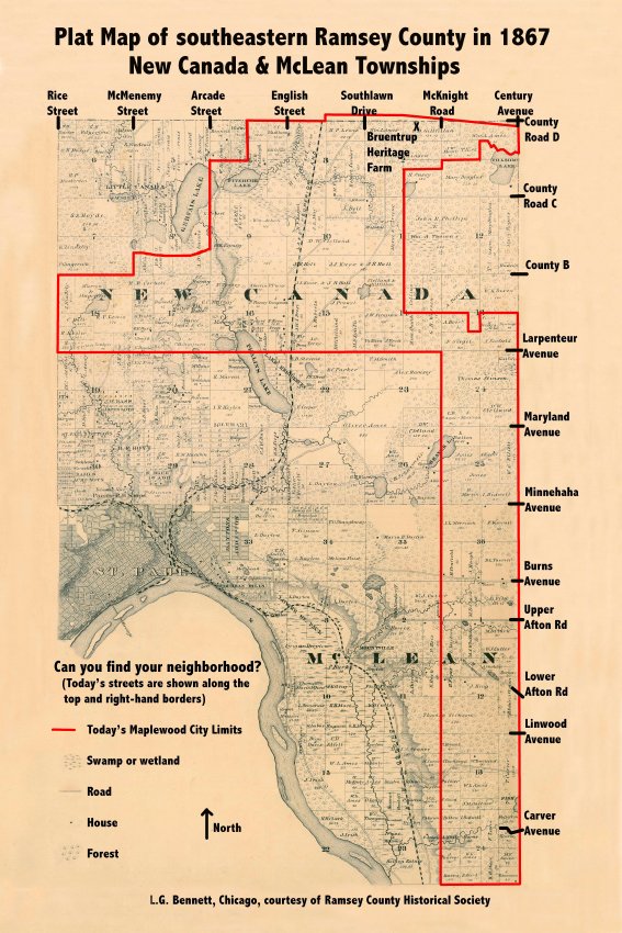
The area south of Hudson Road became McLean Township when Minnesota became a state in 1858 and the area north of Hudson Road was New Canada Township. New Canada’s first town meetings were at a school building in today’s Little Canada. McLean’s meetings were at a school building near Point Douglas Road and Lower Afton Road. In 1879, New Canada Township built a more centrally-located town hall near the north shore of Lake Phalen. This was moved to Gladstone around 1900. In 1888, the residents in the northeast corner of New Canada voted to withdraw from the Township to incorporate as the village of North St. Paul. During the last half of the 19th century, the City of St. Paul repeatedly annexed land from both townships and around 1890, the remaining five square miles of McLean merged with New Canada to create today’s southern leg of Maplewood. Annual township meetings were a big event and the little town hall was packed with residents. By the early 1950s, the town hall was sold and the township offices were moved to a back room of the Gladstone Fire department with annual meetings held in the Gladstone School.

New Canada Township becomes Maplewood
After World War II, the housing boom began when returning veterans started families, received low financing rates on new houses, and sought city water, sewer, and better roads. This led to many debates at township meetings between the new residents wanting improved services and the older residents who did not want the increased taxes. In 1953, residents of Little Canada broke away from the township to incorporate as a village. The Township had increased to 14,200 residents, had appointed a planning commission, adopted building code, and had two constables. In 1955, 3M built its Central Research Laboratory on 150 acres along Highway 12 in the Township. This land was outside the city limits of St. Paul but rumors began that St. Paul wanted to annex the area for the additional taxes. After much discussion, the residents of the Township voted to incorporate as the village of Maplewood on February 26, 1957, by a vote of 5 to 1. This kept 3M on the village tax base and also allowed the village to become eligible for a share of the state gasoline tax.

This 1927 photo shows the Julius Ickler farm on highway 12 where 3M built their Central Research laboratory in 1955. The highway later became I-94.
Early Maplewood Government
Waldo Luebben was the first mayor and many of the former New Canada Township Supervisors became village officials. Ed O’Mara suggested the name “Maplewood” for the new village and Warren Berger found a maple leaf in his backyard and traced the outline for the village logo. For a few years, life was much like that of the former township with offices located in Gladstone. The Engineering Department was in a former barbershop and grocery store. The town constable slowly evolved into the Maplewood Police Department with offices in a converted house. Fire protection for the township was started in the mid-1940s by the Gladstone volunteer fire department and was soon joined by the Parkside and East County Line volunteer departments.
In 1997, these organizations merged to become the Maplewood Fire Department. In the 1950s the decision had been made to consolidate the village departments in a new municipal building. But construction was so slow that Building Inspector Oscar Londin was alleged to have grabbed a shovel and said “I’ll do it myself!” The two-story municipal building was finally completed at 1380 Frost Avenue in 1965. The residents voted to adopt the council-manager system in 1968 and the village became a city in 1974. It only took twenty years to outgrow the two-story municipal building and in 1985 a new city hall was built at 1830 East County Road B. In the year 2000, the population of Maplewood was 35,258 and covered an area about 18 square miles – this is ½ the size of New Canada Township when it was created in 1858.

Maplewood’s municipal building on Frost Avenue
Farms are replaced by Suburbs
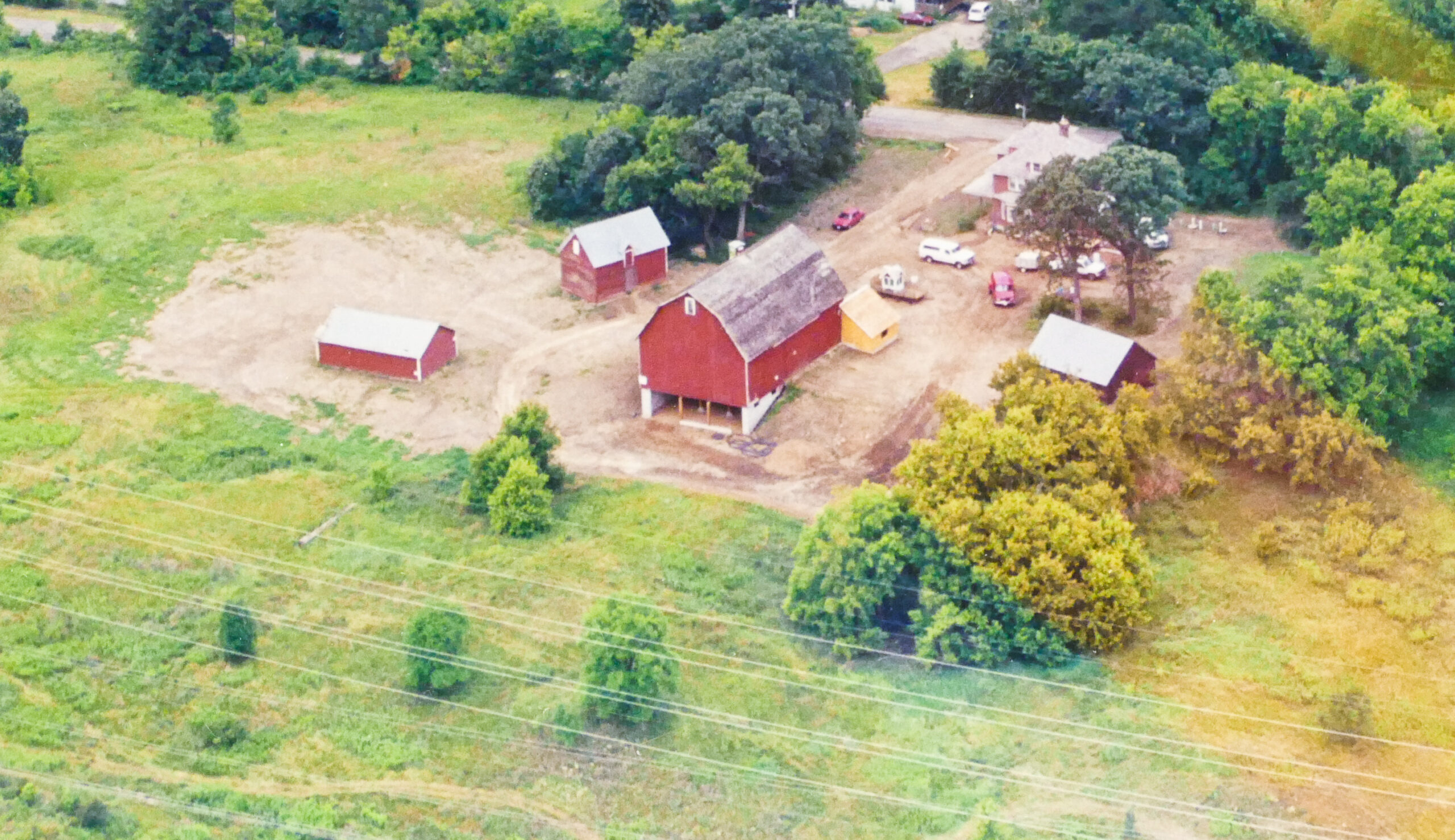
Market gardening (today we call it truck farming for the raising of vegetables for commercial sale) was the main industry in McLean and New Canada Township through the first half of the twentieth century because of the close proximity to the Farmers Market in St. Paul. Dairy farming was also popular and milk was shipped to creameries in St. Paul or delivered directly to homes by local farmers. But as property taxes increased and land prices soared after World War II, these farmers could no longer make a living from the land and began selling small plots to developers for houses, retail stores, and highways. Highway 36 was completed in 1955 and Maplewood Mall, I-94, and I-694 were all opened in the early 1970s. The last operating farm was probably the Bruentrup dairy farm on White Bear Avenue where the last hay crop was cut in 1998. In 1999, these buildings were donated to the Maplewood Area Historical Society and moved to city-owned Open Space along County Road D to become the Bruentrup Heritage Farm.


